
When choosing a GPS device suitable for mountain biking, it is essential to select a device with some key criteria. You might as well say it right away: NO, a car GPS, a road bike GPS or a smartphone is not necessarily suitable for mountain biking. There it is.
There are many features to take into account for an MTB GPS, but some are crucial for comfortable use. We give you tips for making a safe choice and our recommendations for current products.
Please note, as mentioned above, these criteria are quite different between road bike use and mountain bike use. GPS for mountain biking are closer to “outdoor” or hiking GPS, which enhance the ease of navigation, than to GPS intended for road biking in the minds of manufacturers (light, small, aerodynamic and very very performance oriented) .
Important criteria for choosing an MTB GPS
The type of cartography that can be used on the GPS and their readability: topo IGN maps, OpenStreetMap maps, raster or vector maps, map prices, possibility of modifying or improving maps.
Autonomy: The device must be able to operate over a long period of time, at least on a one-day trip, more in the case of roaming, as well as the ease and speed of recharging the batteries (USB or specific connection) or replace the battery,
Robustness and waterproofness: a necessity during rainy and muddy outings.
The quality of the signal reception: Your geographical location depends on it. During your mountain biking trips, it is crucial to be able to know your location quickly.
The size and readability of the screen in direct sunlight and in dark places such as woods, its ability to vary the brightness automatically according to the ambient lighting to optimize battery life while maintaining readability,
The positioning of the buttons (avoid GPS with difficult to access buttons),
The tactile capability of the screen if it has one: it must be able to be used with gloves and not be too sensitive (in the event of rain!).
An altimeter with efficient performance, in order to accurately determine your altitude and estimate what remains to be done to measure your effort, barometric or based on GPS information (less precise),
Connectivity, to connect the bike GPS to a PC or a smartphone to charge and unload tracks, so with a USB cable or better, wireless (WiFi, Bluetooth, etc.).
Compatibility with standards (eg ANT +, Bluetooth Low Energy) to connect sensors, heart rate, speed, cadence, even power,
The fixing system on the handlebars of the mountain bike or the stem which must be robust and practical,
The ability to recalculate the route in the event of a deviation from the track: this system, put forward by several manufacturers, is not yet fully adapted to mountain biking (based on information from the map), but can prove useful for a quick return to the starting point or recovery of the paved road network.
And why not use a Smartphone?
You probably have a smartphone, and GPS navigation phone apps are a pretty good replacement for MTB GPS. However, smartphones are much more fragile than outdoor GPS, often more expensive and are less efficient in terms of battery life and location accuracy.
Basically it does the job , but if you are a regular practitioner, you will quickly reach the limits of the smartphone, which initially is not made to end up in extreme conditions like on the handlebars of an MTB.
However, you can have both the GPS and your phone on the hanger of your bike, which is handy for taking calls, or just taking beautiful photos. We have also studied the best smartphone mounts for bikes .
Comparison of the best GPS for MTB
In basic mode, the MTB GPS works like a classic computer and allows you to record your positions, calculate statistics and retrace your route at any time. This capability is made possible by satellite positioning. The device displays all the information about your performance and location.
In fact there are several positioning services via satellite constellations: the American GPS, the Russian GLONASS, the European Galileo, the Chinese Beidou (or Compass). Recent sensors offer to choose which constellation to use to obtain the position.
The American Garmin is the undisputed leader of the sports GPS market, it is the manufacturer who innovates, followed by some rather aggressive challengers, such as Wahoo, Hammerhead, the Taiwanese Bryton or the Spanish TwoNav.
The spectrum of products and functions is wide: Touch screens and record autonomy, real-time performance and location monitoring for remote monitoring, full connectivity (WiFi, Bluetooth, BLE, ANT +, USB), provision of complete map data : vector, raster, IGN topo and openstreetmap, automatic routing to reach a destination (still far from being suitable for mountain biking, we talk about it in this article ).
On the price side, high-end GPS like the Garmin Edge 1030 plus cost more than € 500. On the other side of the scale, some entry-level GPS, like the Bryton Rider 15 neo , are extremely simple and very affordable to purchase. However, these are more counters for tracking statistics, but still based on the GPS system. Thus, you can read rudimentary information on your route (distance, time, average speed, etc.). There is no mapping function . To be reserved for monitoring, but to be eliminated for use in “adventure” mode and navigation with guidance. A connected watch without cartography does the same job although the offer tends to approach the functionalities of conventional GPS.
Recommended mountain bike GPS
Depending on the brand, different models of GPS are available. They are generally designed according to the functional needs of the practitioners.
Several bicycle GPS devices, which can be widespread in the cycling community, are not part of our recommendations: they may be very good products for road cycling, but not necessarily well suited to mountain biking, or in all cases. case, mountain biking as we understand it on UtagawaVTT, in discovery mode of territories, nature and not in “performance” mode.
We also do not include in our recommendations connected watches that are not very suitable for use for guidance or navigation (because the screen is too small). They can, on the other hand, prove to be a very good complement for recording the track, be followed in real time while collecting physiological information such as heart rate and more generally statistics of a sporting activity.
Garmin Edge Explore: The affordable option
The Garmin Edge Explore is one of our favorite recommendations, even against the super high-end Garmin Edge 1030 plus one of the most powerful GPS, premium model of the range of GPS dedicated to cycling at Garmin, but which is about 2 times more expensive.
More suited to mountain biking than road cycling, Garmin has placed the emphasis, with the Edge Explore, on connectivity rather than performance.
Equipped with a bright 3-inch touchscreen, it comes standard with the preloaded Garmin Cycle Map Europe. Interest or gadget, it uses a popular route generator to show you which routes cyclists take the most, with precise navigation directions. It is compatible with cyclist safety accessories manufactured by Garmin (rear radar for example). Autonomy according to the manufacturer is given for 12 hours.
You can also install the Garmin France Topo V5 IGN map , it will cost you a few hundred euros more. You can even customize it by following this tutorial or even install your own free maps based on OpenStreetMap.
The Garmin Edge Explore stores all available data in memory and makes it usable when there is no network coverage. You can also use the turn-by-turn guidance option to make sure you get to your destination. For group runs and hikes, Garmin Connect enables data sharing between cyclists.
Its high connectivity (WiFi, Bluetooth, Ant + and smartphone) allows it to be ultra communicative, it is also connected to the Strava, GPSies and Wikiloc track sites.
Its main flaw remains the absence of a barometric sensor which forces it to obtain the altitude setting thanks to GPS data: a problem which is solved with the EDGE 530 and 830 which are even more suitable for mountain biking without going as far as to the ultimate performance of the Edge 1030 plus
The screen has a perfect size: visibility, perfect sensitivity. The responsiveness of the screen is very functional even with gloves.
The possibility of customizing the screens is sufficient: 2 screens of info, altitude, map, compass.
The mapping that comes standard is not ideal for mountain biking, but that’s okay! See our article to obtain free fund maps or to acquire France Topo.
The GPS part is precise and the acquisition fast. No loss of signal. The only point to monitor the cumulative altitude in fact, the test generates a difference between the display of the GPS and the reality on the ground. This is confirmed during the transfer to Garmin express where there is the good cumulative elevation. This may be due to the fact that this model manages altitude by GPS only and does not have a barometric altimeter.
For the software side, it is less the gas plant than the Edge 8xx series and that is the goal of this model, less sections, but the essential is there, clearer. A positive point for the Widget screen, which is simpler, and above all the screens are separated for notifications, the weather … which makes the whole more readable.
The battery which seems to drop quickly, but without exaggerating either after 4 hours there was 77% autonomy.
For guidance, very good. Loading routes is a formality. The following turn by turn and the indications work very well, you have to remain vigilant it is easy to make mistakes.
To summarise :
Good points :
- Screen
- Reactivity
- Software
- Autonomy
- Price
Negative points :
- The management of altitude and height differences which does not rely on a barometric sensor.
In short, a good product, simple, efficient and for a price “less Garmin” than usual. Adventurers will be delighted, performance freaks will undoubtedly be disappointed. So if you are looking for an easy to use GPS without performance tracking like an Edge 830 or Edge 1030 plus can be then this is a great product.
TwoNav Cross: Raster maps and screen quality
The TwoNav Cross is a hybrid evolution of the Trail and Horizon (Bike) models and has a perfect screen size and impeccable display fluidity. It is very readable, very bright even in strong sunlight.
In line with the reputation of the brand, it is a very good GPS. The policy of the Spanish manufacturer is to manufacture locally and no longer in Asia.
It has everything you need in a strong and light case where the battery is integrated and irremovable.
Strengths
- Multi-constellation use: GPS, Galileo and Glonass
- The possibility of having the IGN topo raster maps (no other GPS offers this) with sufficient internal memory to have complete countries
- Continuity of use between the brand’s various products, including the TwoNav smartphone application, the excellent Land route management and mapping software
- SeeMe real-time tracking function offered for 3 years with GPS
When using the GPS, it can be installed in 1 click on the hanger with a device compatible with the other models of the brand. The case of the Cross is massive and solid and we are really impressed by the readability of the screen. The touch function on the screen is very responsive and the map moves very smoothly. The manufacturer has doubled the touchscreen functions of the screen with physical buttons on the sides of the GPS, a good point for use with gloves.
As with all TwoNav’s GPS, we find a very complete menu for the configurations, and since we like to personalize, we obviously did it! Suddenly we end up with the information that we find useful on the map page and the information page (time, sunset time, altitude difference, average speed, distance traveled, distance to arrival (ETA) , duration in motion). GPS supports most ANT + and BLE standard sensors. In a few seconds the pairing is done.
Tracking the route on the map is very easy, you can change the color and thickness of the track to follow on the map and deviations from the route are well indicated. Relief and shading can be displayed to aid navigation (we talk about it here )
On arrival, synchronisation with Land or the GO Cloud is done automatically once the GPS is connected to the PC or if the GPS WiFi has been configured. The GPS points recorded along the route are very precise even in the undergrowth.
Thanks to a companion application on Smartphone ( TwoNav Link ) it is easier to configure the GPS and extend its functionality in particular to retrieve and follow GPS tracks taken on sharing sites such as UtagawaVTT.
To summarise :
Good points :
- The only GPS for mountain biking with IGN raster background maps as on paper maps
- Very comfortable screen
- The Land software suite and the TwoNav tools ecosystem
- The scope of the parameterization
Negative points :
- The complexity of the menus, the hyperconfigurability has a price …!
Garmin Edge 830: Perfect for the trails?
The Garmin Edge 830 is a GPS truly dedicated to mountain biking. Garmin in its latest feature updates has filled in the gap in its rather GPS-oriented Edge range for road bikes, compared to trail use.
The Garmin Edge 830 GPS has a touch screen. It works very fast and is qualified not to break down in case of humidity (rain, mud ok). The 3-inch screen size is ideal for mountain bikers, it can be installed on the handlebars, the stem or as a deported one.
Similar to the Edge 530, the main difference from the 830 is the touch screen and the ability to do real-time routing (useful if you are lost): You just have to choose an end point and the GPS plans a route by following on the roads of your choice: asphalt or off-road trails.
As on all Garmin you can install, in addition to the preloaded map, the IGN Garmin France Topo V5 map , it will cost you a few hundred euros extra. And like the Edge Explore, you can even customize the Garmin map or even create and install your own OpenStreetMap based maps .
It has the ClimbPro function displaying the altitude profile (percentage of average slope, height difference remaining to be climbed, distance to the top with color display of the slope according to the difficulty), a route generator, a Trailforks function displaying the difficulty of mountain biking trails, assistance for electric bikes, applications for the weather forecast (Garmin IQ widgets).
The Garmin Edge 830 is also equipped with a fall detection function and assistance in the event of an incident by calling a programmed number. Rather practical, it has an alarm if the bike is moved (theft for example) and a function to find the GPS in the event of loss following a fall.
More complete than the Edge Explore, less expensive than the Garmin Edge 1030 plus, more practical to use than the Edge 530 (which is basically the same, but less practical, because without a touch screen and without routing), it is a very good product, really ideal for the MTB that GARMIN has released!
To summarise :
Good points :
- Screen
- Reactivity
- MTB specific functions
- Autonomy
- Price
Negative points :
- A GPS perfectly adapted to mountain biking. The functionalities are very complete, the autonomy is sufficient and the price in relation to the quality of the product.
Bryton Rider 750: Hyperconnectivity and speech recognition
With its experience of several years in the world of GPS, the Taiwanese manufacturer is releasing a color, tactile model with very wide connectivity (up to Garmin radars).
The GPS is based on the successful design of the 420 by happily modifying the buttons that are now on the sides of the screen. As always with Bryton, the coupling with the smartphone and the Brtyon application is done without problem and there are all the GPS parameters to adjust the display configuration and up to 3 bike profiles.
The arrival of the touch screen and color is welcome, the readability is perfect. As on all touch screens, you will be a little bored in winter when you put on your full gloves, but a cleverly placed button allows you to change the displays. It’s even possible to add very readable graphics on the screen, especially on heart rate tracking if you have a suitable sensor .
Bryton is ramping up with this model which features OpenStreetMap based cartography including trails. A good point to find your bearings. The Taiwanese are also innovating: you can even talk to the GPS to indicate a destination, which is practical rather than typing the address on a keyboard.
To send a GPX file to the GPS it is not yet trivial, you must go through the smartphone and send the GPX file by email or via Google Drive on Android (Dropbox does not currently work) to open it in the Bryton app. Gone are the days when you could send it to a directory by plugging in a USB cable, it seems. This is probably the price to pay for switching to the Android system.
In navigation mode, you can clearly see your position on the map, it is a good help, but as soon as you leave the road network, the guidance becomes more random. Also, the map is a proprietary version of Bryton which is not the topo map we may be used to on mountain biking. Perhaps the manufacturer will give the possibility to build its maps yourself to find your way on a more mountain-biking-oriented background.
At several tens of euros less, the Bryton 750 is clearly positioned as an alternative to the Garmin 830, but some early errors must be corrected for it to be up to the task. Bryton’s responsiveness to close the gap should not be compromised and we will be sure to update his lines as changes evolve.
To summarize :
Good points :
- Display
- Voice search
- Connectivity (VAEs, sensors, ecosystem of bike sites)
- Price
Negative points :
- Mapping too light off-road (more info required on MTB)
Import / Export of GPX files and off-road navigation
Bryton Rider 15 neo: the simple GPS computer
It is a GPS counter to record your routes as a navigation aid, there is no mapping or navigation possibility.
The Bryton Rider 15 neo allows you to have the GPS tracks of your route as well as all the usual features of a computer (instantaneous / max / average speed, distance, cumulative distance, etc.). There are even training features. The screen is very readable and the GPS super light.
It is waterproof and with the USB connection it is possible to easily recover the files corresponding to your tracks. Its monochrome display allows it to have excellent battery life.
Our recommendations
As usual, it depends on your usage and your budget, take the time to study the technical specifications of the products in detail and read the feedback from other users!
Garmin Edge Explore
The reputation of Garmin in a simple product very suitable for mountain biking. It does all the right things without going for the excess performance gadgets. A very good value for money
Negative side, no barometric altimeter.
A mid-range well suited to mountain biking
TwoNav Cross
Garmin’s Spanish challenger offers a very complete, robust product with impeccable screen quality, good battery life and access to the TwoNav ecosystem. Real advantages with the SeeMe live monitoring function (3 years included free of charge), automatic synchronization and above all the possibility of having the real IGN (raster) basemaps which are very useful for mountain biking.
Mountain biker looking for a very complete product with raster maps, very configurable and at an attractive price
See the price
Garmin Edge 830
A very complete GPS and really designed for mountain biking. Responsiveness, readability, the power of the GARMIN ecosystem for functionality and maps. A very good choice for mountain biking!
Mountain biking in the forest, uphill, in the bike park, on the road. Very full !
See the price
Bryton 750
Very readable color and tactile GPS with hyperconnectivity for the sensors. Possibility of talking to the GPS to indicate a destination.
Negative point: the cartography and navigation moderately adapted to routes outside the road network.
An innovative alternative at a very attractive price
See the price
Bryton rider 15 neo
An extremely simple GPS counter which gives all the necessary information during the MTB session and which records your tracks. A very large autonomy. And full connectivity to a smartphone to receive (if you feel like it) notifications on the go.
Warning : no guidance possible, nor mapping.
Record your routes and have basic information, have phone notifications in front of you
Other Accessories
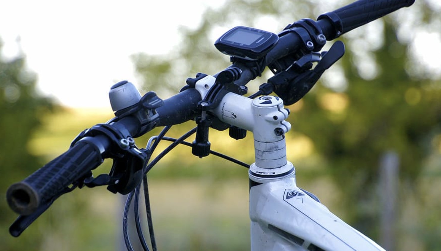
If you have several instruments on your cockpit, it sometimes becomes complicated in terms of footprint. In addition, with current handlebars and their tendency to have a fluctuating diameter, i.e. oversized at the stem level and progressively thinner towards the grips, it is not uncommon for the holder of the instruments to quickly become broken.
To avoid this hassle, it is possible to install an extension bar to fix up to 3 instruments, for example: a GPS, a smartphone, a light.
This makes it possible to regain optimal ergonomics.
To choose well, you need a bar of constant diameter, with fixings that do not move, and which is light.
Check out our collection of GPS and Navigation Devices.